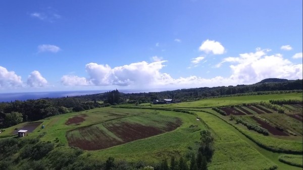
As an innovator and marketer of real property in Hawaii, I have always used technology in any shape or form that works to convey the spirit of the property being offered in whatever form works to deepen a buyer’s understanding of property before visiting it. The below photograph shows the rolling beauty of land in Haiku.

Aerial Photography and Video is a fantastic way to convey the intricacies and abject beauty of Vacant Land on Maui, so I was one of the first agents to offer Drone photography to my listing clients. The only challenge in doing so was in complying with the FAA’s ruling that only hobby flying of Drones is allowed. Any commercial flights would require an FAA exemption – an arduous process with a long list of requirements, one of which is that the operator of the drone have an active Pilot’s License.
Today the FAA Has Announced Part 107 Rule
Relief is in sight based on today’s announcement of new regulations concerning small UAS (Unmanned Aircraft Systems or Drones). From the FAA’s Press Release:
“According to industry estimates, the rule could generate more than $82 billion for the U.S. economy and create more than 100,000 new jobs over the next 10 years.”
The new rules will make it much easier for people such as myself to veer out of the “hobby zone” and into what is considered commercial activity, such as photographing a house from the sky for an MLS listing. This new ruling is anticipated to take effect in August 2016.
Here are a few of the reasonable requirements laid out under the new regulation:
- Visual Line of Sight only (operator must be able to see the drone at all times – no flying behind buildings)
- Drone must weigh less than 55 pounds
- Daylight only operations, or civil twilight (30 minutes before official sunrise to 30 minutes after official sunset, local time)
- Maximum altitude of 400 feet above ground
For a summary of these regulations, check out Part 107 Summary, or visit FAA Fact Sheet.
Great Uses of Drones For Real Estate
Not only are drones fantastic for taking pictures and videos, they can also be used in other creative ways:
- Inspecting roofs or hard to reach areas during home inspections
- Generating 3D Topographical models of complex terrain via PX4D and other software systems
- Understanding Steep Gulch edges or other challenging terrain
- Showing distance between a condo and the beach or other data that can only be understood via higher elevation aerial views
Here’s a video shot using a DJI Phantom 3:
If you would like to talk about leading edge marketing for your vacant land, please call or text me and we can get rolling and flying.
Liam S. Ball, R(B)
808.280.7809
[email protected]

Tim Stice
June 22, 2016
Thank you for the info Liam!
Tim Stice
June 22, 2016
Thank you for the info Liam!